- Volcanic activity beneath the West Antarctic Ice Sheet is accelerating collapse of the Thwaites Glacier, a new study finds.
Here us the UPDATE via What’s Up With That! (Remember, Thwaites is close to a volcano [see below in original post])
Remember the wailing from Suzanne Goldenberg over the “collapse” of the Thwaites glacier blaming man-made CO2 effects and the smackdown given to the claim on WUWT?
Well, never mind. From the University of Texas at Austin and the “you can stop your wailing now” department, comes this really, really, inconvenient truth.
Researchers find major West Antarctic glacier melting from geothermal sources
AUSTIN, Texas — Thwaites Glacier, the large, rapidly changing outlet of the West Antarctic Ice Sheet, is not only being eroded by the ocean, it’s being melted from below by geothermal heat, researchers at the Institute for Geophysics at The University of Texas at Austin (UTIG) report in the current edition of the Proceedings of the National Academy of Sciences.
The findings significantly change the understanding of conditions beneath the West Antarctic Ice Sheet where accurate information has previously been unobtainable.
The Thwaites Glacier has been the focus of considerable attention in recent weeks as other groups of researchers found the glacier is on the way to collapse, but more data and computer modeling are needed to determine when the collapse will begin in earnest and at what rate the sea level will increase as it proceeds. The new observations by UTIG will greatly inform these ice sheet modeling efforts.
Using radar techniques to map how water flows under ice sheets, UTIG researchers were able to estimate ice melting rates and thus identify significant sources of geothermal heat under Thwaites Glacier. They found these sources are distributed over a wider area and are much hotter than previously assumed.
The geothermal heat contributed significantly to melting of the underside of the glacier, and it might be a key factor in allowing the ice sheet to slide, affecting the ice sheet’s stability and its contribution to future sea level rise.
The cause of the variable distribution of heat beneath the glacier is thought to be the movement of magma and associated volcanic activity arising from the rifting of the Earth’s crust beneath the West Antarctic Ice Sheet….
…read more…

Policy Mic had this “scary” picture above, and blamed essentially man-caused global warming, rather than natural causes. Carbon as the driver has been disproved by the evidence (here and here for instance). Likewise, the above was expected — for quite some time — as Hockey Schtick explains:
The “collapse” of the “unstable” West Antarctic Ice Sheet in the headlines this week is actually very old news about a natural process that began at least 1-2 centuries ago, long before man could have had any possible contribution. Studies indicate collapse and complete disappearance of the West Antarctic ice sheet is typical of interglacials. Open seaways were present across West Antarctica at various periods even during the past one or more interglacials. There is, however, no evidence linking this phenomenon to man-made CO2, nor any evidence man can do anything to stop this natural process.
Because “Antarctica is so harsh and remote…scientists only began true investigation of its ice sheet in the 1950s. It didn’t take long for the verdict on the West Antarctic Ice Sheet to come in. “Unstable,” wrote Ohio State University glaciologist John Mercer in 1968. It was identified then and remains today the single largest threat of rapid sea level rise.”
[….]
The new finding that the eventual loss of a major section of West Antarctica’s ice sheet “appears unstoppable” was not completely unexpected by scientists who study this area. The study, led by glaciologist Eric Rignot at NASA’s Jet Propulsion Laboratory, Pasadena, California, and the University of California, Irvine, follows decades of research and theory suggesting the West Antarctic Ice Sheet is inherently vulnerable to change.
Antarctica is so harsh and remote that scientists only began true investigation of its ice sheet in the 1950s. It didn’t take long for the verdict on the West Antarctic Ice Sheet to come in. “Unstable,” wrote Ohio State University glaciologist John Mercer in 1968. It was identified then and remains today the single largest threat of rapid sea level rise.
Why is West Antarctica’s ice sheet considered “unstable”?
The defining characteristic of West Antarctica is that the majority of the ice sheet is “grounded” on a bed that lies below sea level.
In his 1968 paper, Mercer called the West Antarctic Ice Sheet a “uniquely vulnerable and unstable body of ice.” Mercer based his statement on geologic evidence that West Antarctica’s ice had changed considerably many, many millennia ago at times when the ice sheets of East Antarctica and Greenland had not
In 1973, University of Maine researcher Terry Hughes asked the question that scientists continue to investigate today. The title of his paper: “Is The West Antarctic Ice Sheet Disintegrating?” In 1981, Hughes published a closer look at the Amundsen Sea region specifically. He called it “the weak underbelly of the West Antarctic ice sheet.”
Here’s the cause for concern: When the ice sheet is attached to a bed below sea level, ocean currents can deliver warm water to glacier grounding lines, the location where the ice attaches to the bed.
Scientists recognized that this is the first step in a potential chain reaction. Ocean heat eats away at the ice, the grounding line retreats inland and ice shelves lose mass. When ice shelves lose mass, they lose the ability to hold back inland glaciers from their march to the sea, meaning those glaciers can accelerate and thin as a result of the acceleration. This thinning is only conducive to more grounding line retreat, more acceleration and more thinning. In this equation, more ice flows to sea every year and sea level rises.
But that’s not all.
Beginning with research flights in the 1960s that made radar measurements over West Antarctica, scientists began to understand that, inland of the ice sheet’s edge, the bed slopes downward, precipitously, in some cases.
This downward, inland slope was theorized decades ago, but has been confirmed and mapped in detail in recent years by airborne campaigns such as NASA’s Operation IceBridge. In some spots the bed lies more than a mile and a half below sea level. The shape of this slope means that when grounding lines start to retreat, ocean water can infiltrate between the ice and the bed and cause the ice sheet to float off its grounding line.
…read more…
This is UPDATED info via HotAir, and I merely wish to point out that if volcanism starts in the Antarctic, I will Three Stooges slap me some greenie!
…This is not new stuff either. This story has been popping up since 2008. I wrote about it here and here. As noted in 2008, a fairly simple discovery, not mentioned in any of these articles, proffered an explanation of why the ocean water was warming and the ice shelf in question then was melting.
“Scientists have just now discovered an active volcano under the Antarctic ice that “creates melt-water that lubricates the base of the ice sheet and increases the flow towards the sea”. That could include the Wilkins Ice Sheet as well (the article cited talks about the Larson A and B sheets.
But, say the alarmists, we’re not talking about Wilkins or the Larson sheets. We’re talking about the Thwaites glacier.
The study honed in on the Thwaites glacier – a broad glacier that is part of the Amundsen Sea. Scientists have known for years that the Thwaites glacier is the soft underbelly of the Antarctic ice sheet, and first found that it was unstable decades ago.
The University of Washington researchers said that the fast-moving Thwaites glacier could be lost in a matter of centuries. The loss of that glacier alone would raise global sea level by nearly 2ft.
Thwaites also acts as a dam that holds back the rest of the ice sheet. Once Thwaites goes, researchers said, the remaining ice in the sheet could cause another 10 to 13ft (3-4m) of global sea-level rise.
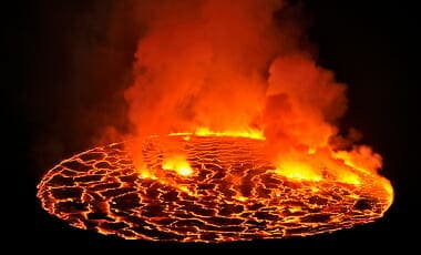
Ok. Well, let’s look at a couple of pictures then. The first is from the 2008 post I did on the volcano:

The second picture, from the Guardian article, shows the area of the study. The red dot is the glacier in question:

Does anyone notice anything interesting? Yes, that’s right, the glacier in question, is in the vicinity of the volcano in question. And I don’t think anyone would argue that a undersea volcano can’t heat up the sea in the vicinity to a little higher temperature than it would be normally. Has it had an effect? Who knows … it doesn’t appear to have been mentioned at all in the study. But, if you go to the Guardian article you’ll see an embedded 17 second video that attempts to explain the effect of the warmer water on the glacier. It shows less dense (and therefore lighter) warm water somehow flowing under much denser and therefore heavier cold water to destabilize the glacier. The only reasonable explanation for such a flow would be if the heat source were somewhere near the bottom of the ocean, no? Otherwise its hard to explain how that warm water got below the cold water and stayed there.
But if you question things like this, you’re an ignorant nincompoop. A “denier”…
…read it all…